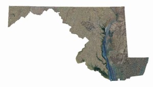
 Maryland’s orthoimagery program recently benefited from two milestones: the 2013 Eastern Shore imagery project (covering nine counties) was completed, and a multi-year contract was awarded to Axis Geospatial and URS Consultants for future orthoimagery program updates.
Under the first phase of the new contract 4-band 6” high resolution orthoimagery will be produced for western shore counties, including the city of Baltimore. Funded by the Emergency Number Systems Board (ENSB), program management is being overseen by the Department of Planning (MDP) and the State’s GIO Office, with support from state and local partners. The new contract provides “buy up options” for enhanced imagery products (3” resolution, near true orthos), planimetric mapping, LiDAR, oblique imagery and land use/land cover mapping. Several organizations have committed to one or more buy ups, and others are under consideration.
 Like most technology initiatives, users want faster, better and less expensive orthoimagery. We are trying to avoid the classic dilemma of only being able to pick two of the three – let’s say, faster and cheaper, but not better – to achieve all goals through workflow planning and by leveraging new technologies.
From the photogrammetric technology perspective, advancements in Airborne GPS, Inertial Navigation Systems and digital cameras have improved efficiency and quality. For the 2013 Eastern Shore project, a second-generation digital camera system (ZI DMClle) was used for a portion of the project area. This newer camera provides the same level of accuracy and resolution at a higher flying height (6000’ AMT versus 5000’). For the 2014 program, the latest large-format high-resolution camera system from Microsoft (yes Microsoft!), the UltraCam Eagle, will be used. This will allow an even higher flying height (7200’) while maintaining the same accuracy and resolution. The increased flying height will reduce the number of exposures by almost 50 percent. Reduced exposures mean faster photo acquisition, fewer models to triangulate, less control and fewer seamlines. The higher flying height also means less displacement for elevated structures (buildings), less warping in mountainous areas and, because the acquisition will be over a shorter timeframe, should provide more consistent radiometry.
The use of a web-based online QA/QC application first implemented with the 2011 program and enhanced in 2013, has eliminated the need to transmit data (via DVD or ftp) until all products are accepted. Quality has also been improved by enabling local review of the data earlier. The QA/QC subcontractors’ use of the same tools as those used by the state/ local agencies has also improved efficiency and quality. Those same tools also will be used for the 2014 program.
The other major workflow change being implemented for 2014 is the use of the latest LiDAR data. The Eastern Shore Regional GIS Cooperative, with support from other state, federal and local agencies, has collected the latest LiDAR data statewide and produced standardized DEM products and map services. This work, along with the eight counties getting new LiDAR in 2013 or 2014 via USGS or county contracts, means that new, highly accurate LiDAR can be used to support the orthorectification process, and is expected to improve accuracy.
Early contracting, increased capacity, stable specifications and contractor continuity have shortened what used to be an 18- 24-month project to 12 months in 2011. For the Eastern Shore project, it took about nine months from the first day of flying to final delivery.
The combination of new technology, detailed specifications, workflow modifications and a competitive marketplace have significantly reduced costs. For example, the cost for western shore counties has dropped by about 25 percent since the 2011.
All imagery products are available on MD iMap, and from county, state and federal agencies.
Everything is in place for the next update cycle …….. now just hoping the leaves don’t come out on the trees too soon.


