As I have been working in the GIS field for over 10 years in Maryland, I have met some interesting, talented, intelligent, and motivating GIS colleagues along the way. Hopefully this reinvigorated blog series will share with you some exciting tidbits of information from each person who has touched my career in some way. Here are some fun facts about Roger!
 |
Quick Facts about Roger Barlow
|
Tell me something fun about your job.
The position I have enjoyed up until now has offered me the chance to form partnerships for acquiring and sharing geographic names, orthoimagery, elevation data, and hydrography data. Working with 14 states over the course of time to facilitate the exchange of base cartographic data themes totaling millions of dollars since 1993 has been personally most rewarding. I am very sad to see the demise of partnership roles of the USGS Liaisons which have been in place since the early 90s, which I had a large role in expanding.
What is one of your favorite hobbies?
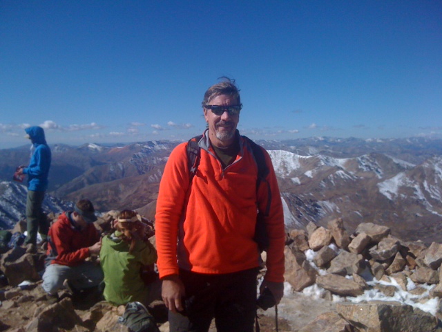
For spare time I continue to play volleyball in indoor and outdoor leagues, and the occasional tournament. I’ve been lucky to have played in 3 USA Volleyball Indoor National Tournaments as a setter. I have played in New Zealand, the Caribbean, and of course Antarctica. I also enjoy climbing “high points”, and have climbed 4 14ers, and some 13,000 foot points in Colorado. I’m looking to hike Mt. Mitchell (highest point in NC), Ben Nevis (highest point in UK), and Mt. Katadhin (highest point in Maine) this year. I enjoy hiking; it satisfies the geographer and a bit of the explorer in me.
What is your favorite GIS book?
I am really much more of a geographer and cartographer than a GIS practitioner. First and foremost maps are a form of communication that too often gets neglected in the computer science aspect of GIS. My college cartography professor Mark Monmonier wrote How to Lie With Maps which explains how our natural bias and those cartographic factors introduced purposefully or not alter our perception of a maps message.
How has GIS changed since you first started your career?
Contrary to the rumors you have heard, I did not work as a negative engraver on copper plates — that was before my time. When I was a college student we used drafting pen, ink, on Mylar and paper backed with wax for “stick-up” map text. You had to know photographic process and even some lithography if you wanted to print a map. Later we were introduced to a mapping program called SYMAP, developed at Harvard. A crude choropleth typewriter over-shading of characters within polygons on computer paper representing different statistical value ranges. One had to enter instructions and data on “IBM cards” a stack of which was often a foot tall held together by thick rubber bands. I was more suited to the “art” and design of cartography via scribing, peelcote done on light tables. At USGS in the early 80s we used the M&S system, a big digitizing table with 2 heads-up displays. M&S later morphed into what we now know as Intergraph Corporation. Nodes, and establishing polygon area-left, area-right, and add feature attribute resulted in simple vector maps. Later in the 80s the raster revolution and the battle of “raster is faster” and “vector is corrector” took place. With the Federal kick-off of orthoimagery in 1990, the integration of raster and vector data types was sealed, and vector data was updated from the rasterized orthoimagery. The limited memory available for any digital cartographic data, and the limited display and sharing of digital data was unleashed by the Internet, and file-sharing first by kilobytes, then megabytes, now gigabytes, onto petabytes of data storage and file sizes. The Global Positioning System used by the military in the 80s, was available to civilians in the 90s, anyone remember the term Selective Availability? Bill Clinton’s 1998 order to descramble GPS signals designed to build in 100-meter errors gave rise to the GPS capability we know today. Enter LiDAR, and hand-held instrumentation for GPS data, or field mapping. Software standards and interoperability also came on in the 90s, imagine if you will various mapping software that doesn’t work with other software you have…you have entered the cartographic twilight zone (insert Rod Serlings voice here).
Where do you see GIS going in the future?
The future to me is 3D mapping and digital cartographic modeling, if we are to convey a clear visual communication of hydro-fracking and its possible impact on aquifers, no better way to display that than a 3-D presentation. Elevation data and flood stages, urban planning, storm surge-modeling, ocean currents, thermoclines, salinity all displayed in 3-D would take on a more intuitive nature for decision-makers and the lay-public. This is also a way to visualize future landscape changes, think of wind-turbine farms in which this practice is already underway.
How did you get interested in the field of Geography/GIS?
I always had an advanced sense of place, my first day of kindergarten the school Principal placed me on the wrong bus home. I had only lived in Penfield 3 months, after every one else was off the bus, I was able to direct the bus driver to my home. As a kid I made maps with colored pencils on dry cleaners shirt cardboards. I memorized state capitals, state nicknames, state square areas, city populations over 50,000. I started reading the road map for family trips. I was able to find a college that specifically had cartography courses and cartography faculty at Syracuse University. I took the civil service exam after graduation, and have been at USGS 36+ years, the first 11 making small scale and thematic maps. Now I have a small feature in Antarctica named after me, and I’m not even dead (yet).
What is one piece of advice you would give to a newbie in the field?
Follow your interest, your passion, meet people, and share information. Balance your professional life with other aspects of your life. Explore. If you are not out there breaking eggs, you’ll never get an omelet or it’s OK to make mistakes, you must learn from them.


