I wanted to keep everyone posted on the most recent updates on the lidar collection in Maryland. I have seen the projected delivery schedule for the NCR QL2 Sandy lidar which includes: DC, most of Fairfax, Arlington County, Alexandria VA, PG, Charles, and St. Mary’s counties. The contractor has completed the Pilot Data phase and USGS QA has approved that phase. This includes Fundamental Vertical Accuracy reporting of unclassified .las points, and 5 sq mile of sample classified points in each major land cover area. The projected delivery date for completed data to be received at USGS from the contractor is May 15. However, the two Sandy QL2 projects I have been involved in ahead of this one required 3 iterations of corrections before the data were approved. I am guessing at least one round of corrections will be needed, then the tiling process will take place.
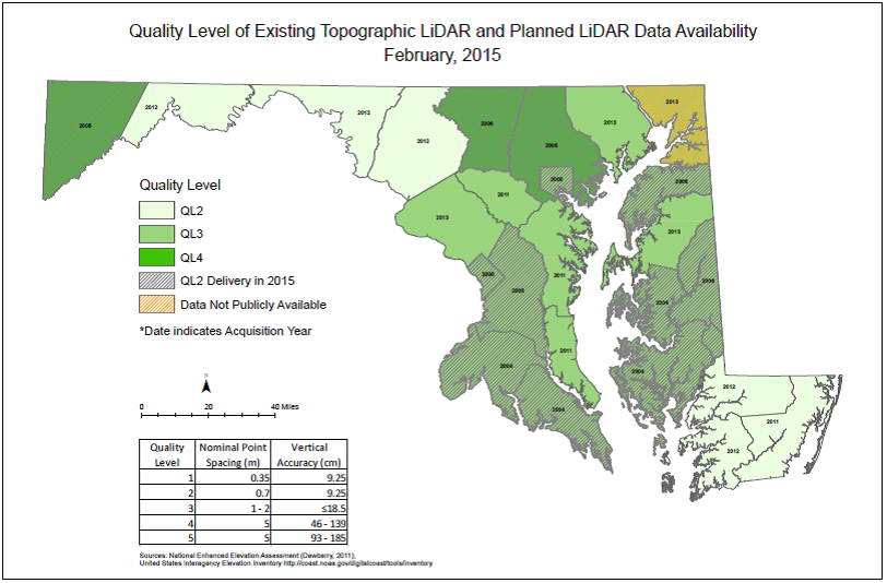
- Garrett County which is NRCS funded, and USGS contracted, aircraft are on-site and projected to begin collection as soon as March 27.
- Baltimore County QL2 lidar has been delivered.
- I am working with NRCS-MD to obtain funding for the production of 1-meter DEM for Cecil County, thus releasing that data set into the public domain. I am expecting news from NRCS on this funding opportunity in early May.
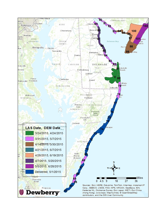
- NOAA-NGS jpg map and delivery schedule which I have attached for Atlantic coastal topo/bathymetric lidar.
- The USGS price range for QL1 data depending on size and location of a collection area; $502/sq mile to $655/sq mile. Note that the 2016 Broad Agency Announcement will be issued this July, and webinars on this topic will be offered likely in May.


